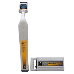
How can I locate and map underground cables in a single survey?
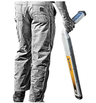
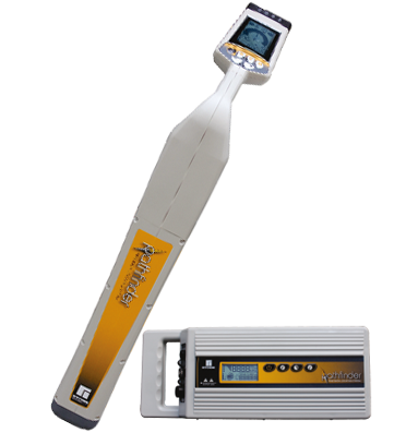
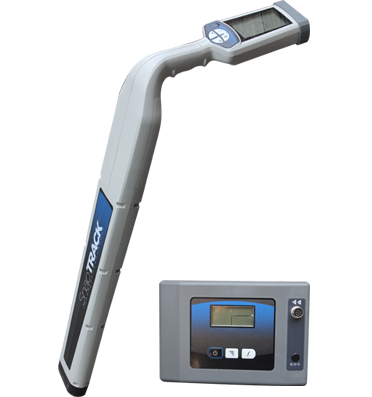
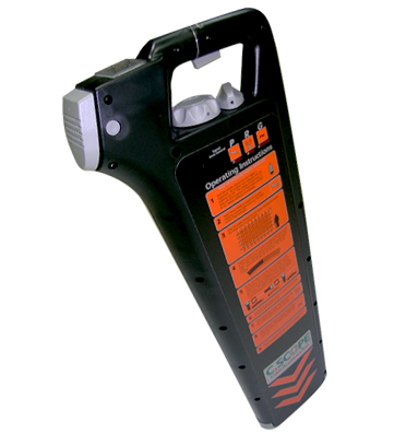
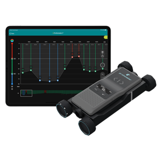
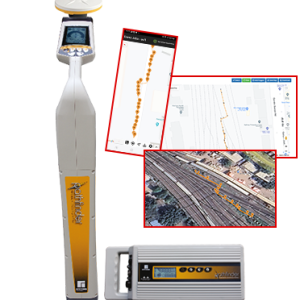
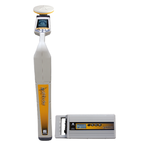
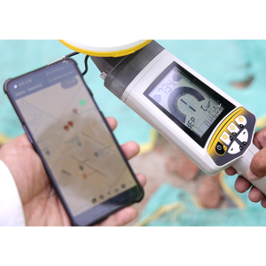
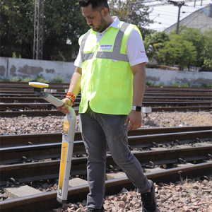
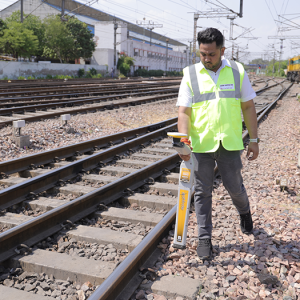
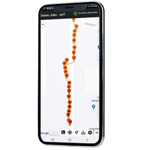
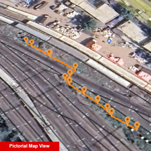
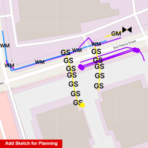
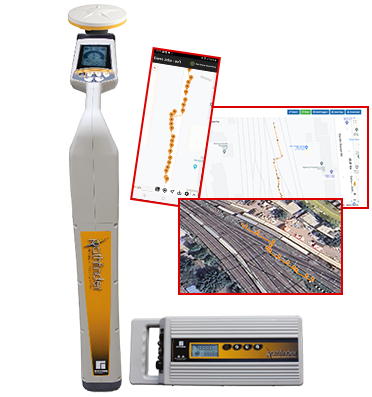
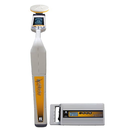
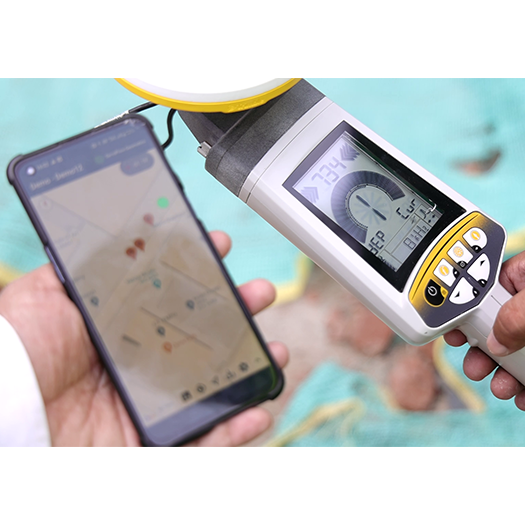
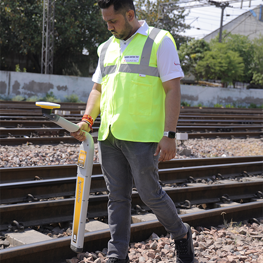
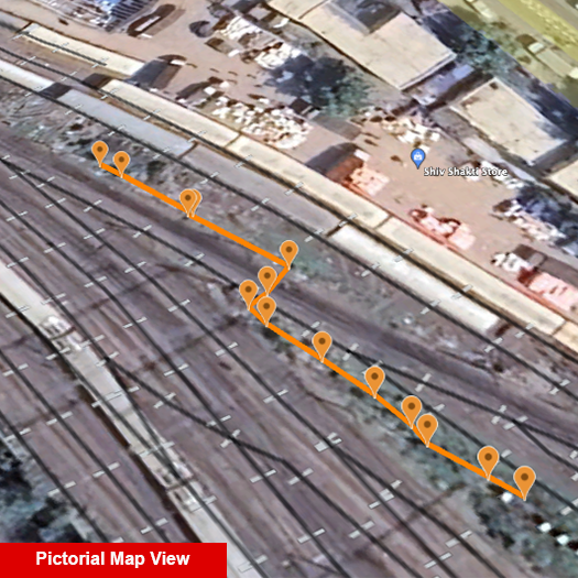
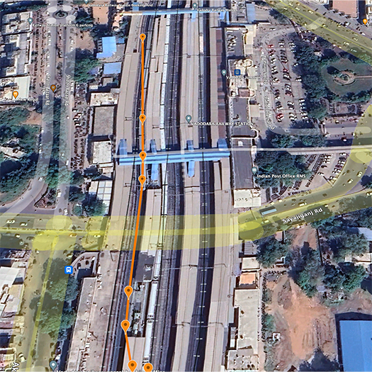
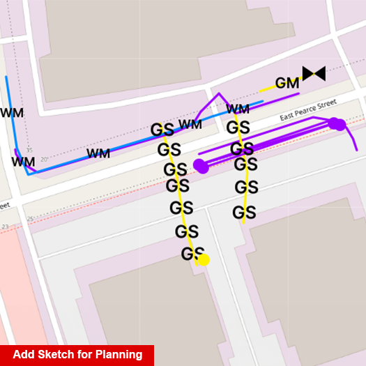
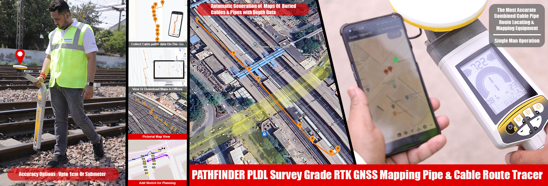
The Pathfinder PLDL allows you to locate, trace, and map underground utilities simultaneously, eliminating the need for separate surveying and mapping processes. It captures route, depth, and GNSS coordinates in real time.
How do I create accurate digital maps of underground utilities?
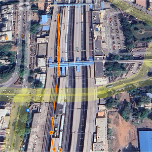
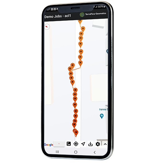
This Pathfinder PLDL uses RTK GNSS technology with up to 5 cm accuracy, enabling survey-grade mapping of buried cables and pipelines. The data is automatically converted into digital maps without manual processing.

What is the best solution for GIS-based underground utility mapping?
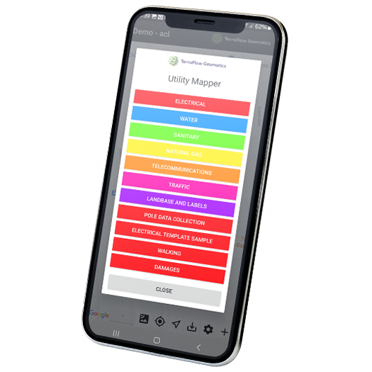
The Pathfinder PLDL integrates with mobile apps and GIS platforms, allowing direct export of data into formats like:
• Google Earth (KML)
• AutoCAD
• Shape files (.shp)
• CSV logs
How can I avoid errors in underground utility mapping projects?
With centimeter-level GNSS accuracy and real-time data capture, this system minimizes human error, ensuring precise and reliable mapping for critical infrastructure projects.
How can I eliminate manual data entry during field surveys?
The Pathfinder PLDL automatically captures:
• Route path
• Depth data
• GPS coordinates
• Time & date
and syncs it directly to the cloud, removing manual documentation entirely.
Can I access survey data in real-time from the office?
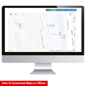
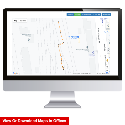
Yes, collected data is automatically uploaded and synchronized, allowing teams to view maps and reports in real time without file transfers or delays.
Can one person perform locating and mapping operations?
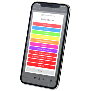
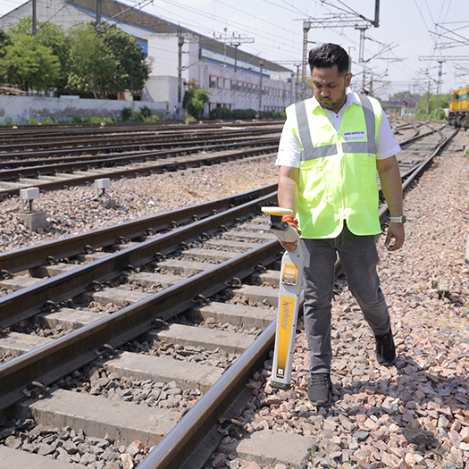
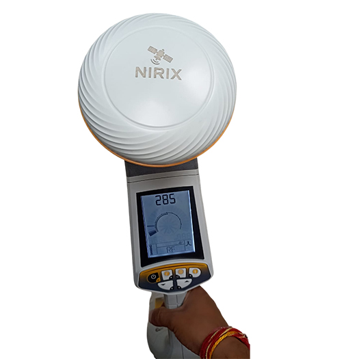
Yes, the integrated GNSS receiver and mobile app enable single-person operation, significantly reducing manpower and project costs.
Why should I choose a GNSS-based cable locator instead of a standard locator?
A GNSS-enabled system not only locates utilities but also:
• Creates permanent digital records
• Enables GIS integration
• Improves asset management
• Reduces repeat surveys
What makes Pathfinder PLDL different from other cable locators?
It combines:
• Multi-frequency locating (36+ frequencies)
• 12W high-power tracing
• RTK GNSS mapping
• Cloud-based data synchronization into a single system for end-to-end utility management.
What types of utilities can this system detect and map?
It can detect and map:
• Underground power cables
• Metallic pipelines
• Telecom fiber cables
• Energized and non-energized utilities
How does this system reduce project costs and delays?
By combining locating and mapping in one process, it:
• Eliminates repeat surveys
• Reduces manpower
• Minimizes errors
• Speeds up project timelines
Can I integrate this system with existing GIS or CAD software?
Yes, Pathfinder PLDL is compatible with major platforms like Esri and AutoCAD, allowing seamless integration into existing workflows.
How do I avoid digging errors during excavation?
Using Pathfinder PLDL:
• Trace exact route of underground utilities
• Map their position with GNSS
• Export data to GIS
What GNSS accuracy does the Pathfinder PLDL provide?
Standard GNSS: Typically sub-meter accuracy
With RTK GNSS integration: 2–5 cm accuracy
Does the Pathfinder PLDL support external GNSS devices?
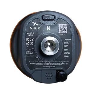
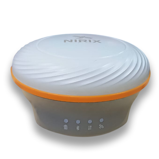
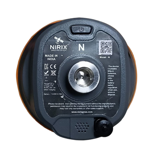
Yes: Supports external GNSS RTK receivers via Bluetooth
What frequencies does the transmitter support?
Multi-frequency operation (typically):
Low frequencies (~512 Hz – 1 kHz) : long-distance tracing
Mid frequencies (~8 kHz – 33 kHz) : general locating
High frequencies (~65 kHz+) : short-distance / congested areas

Why are multiple frequencies important?
• Low frequency : deeper penetration
• High frequency : better in congested areas
What signal modes are available?
Common modes include:
• Active mode (with transmitter)
• Passive mode (detecting existing signals)
What type of receiver technology is used?
Advanced electromagnetic receiver with:
• Signal filtering
• Noise rejection
• Directional detection
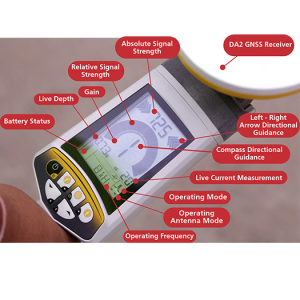
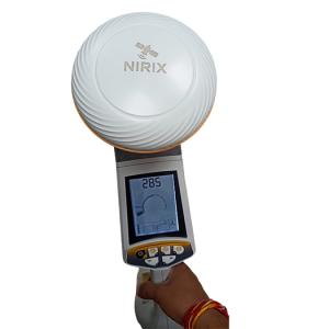
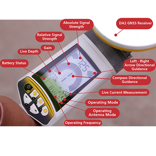
What display information is provided in Pathfinder PLDL?
• Signal strength
• Frequency
• Depth
• Direction
• GNSS data (when enabled)
What connectivity options are available in Pathfinder PLDL?
• Bluetooth
• USB interface
• GNSS integration
What is the power source of the Pathfinder PLDL?
Lithium-Ion Rechargeable battery system, with battery life :Continuous- 30 hours Intermittent- 82 hours
What is the dynamic range of the Pathfinder PLDL receiver and why is it important?
The Pathfinder PLDL offers a dynamic range of 126 dB
Does the PLDL support gain control?
Yes: Manual gain adjustment + automatic centering
Benefits:
• Fine control over signal strength
• Stable readings without signal saturation
• Better accuracy in complex environments
How does Pathfinder PLDL handle interference from high voltage lines?
It includes Automatic Overload Protection
This protects against:
• Signal distortion
• High-voltage interference
• Incorrect readings
What is the accuracy of depth measurement?
±3% accuracy
What is the operating temperature range?
-20°C to +55°C
What is the weight of the Pathfinder PLDL?
~1.9 kg ± 0.1 kg
Benefit:
• Lightweight
• Easy to carry
• Suitable for long field use
What is the purpose of the USB port in Pathfinder PLDL?
The USB port in Pathfinder PLDL Provides:
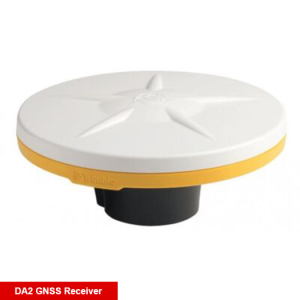
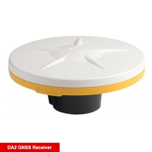
• 5V output to power external GNSS receiver (DA2 GNSS)
• Data connectivity
How many frequencies does the Pathfinder PLDL support?
The Pathfinder PLDL supports: 36+ user-configurable frequencies
Which frequencies are used for general locating?
Common mid-range frequencies:
• 1 kHz
• 8 kHz
• 33 kHz
How can I locate and map underground cables in a single survey?
The Pathfinder PLDL allows you to locate, trace, and map underground utilities simultaneously, eliminating the need for separate surveying and mapping processes. It captures route, depth, and GNSS coordinates in real time.
How do I create accurate digital maps of underground utilities?
This Pathfinder PLDL uses RTK GNSS technology with up to 5 cm accuracy, enabling survey-grade mapping of buried cables and pipelines. The data is automatically converted into digital maps without manual processing.
What is the best solution for GIS-based underground utility mapping?
The Pathfinder PLDL integrates with mobile apps and GIS platforms, allowing direct export of data into formats like:
• Google Earth (KML)
• AutoCAD
• Shape files (.shp)
• CSV logs
How can I avoid errors in underground utility mapping projects?
With centimeter-level GNSS accuracy and real-time data capture, this system minimizes human error, ensuring precise and reliable mapping for critical infrastructure projects.
How can I eliminate manual data entry during field surveys?
The Pathfinder PLDL automatically captures:
• Route path
• Depth data
• GPS coordinates
• Time & date
and syncs it directly to the cloud, removing manual documentation entirely.
Can I access survey data in real-time from the office?
Yes, collected data is automatically uploaded and synchronized, allowing teams to view maps and reports in real time without file transfers or delays.
Can one person perform locating and mapping operations?
Yes, the integrated GNSS receiver and mobile app enable single-person operation, significantly reducing manpower and project costs.
Why should I choose a GNSS-based cable locator instead of a standard locator?
A GNSS-enabled system not only locates utilities but also:
• Creates permanent digital records
• Enables GIS integration
• Improves asset management
• Reduces repeat surveys
What makes Pathfinder PLDL different from other cable locators?
It combines:
• Multi-frequency locating (36+ frequencies)
• 12W high-power tracing
• RTK GNSS mapping
• Cloud-based data synchronization into a single system for end-to-end utility management.
What types of utilities can this system detect and map?
It can detect and map:
• Underground power cables
• Metallic pipelines
• Telecom fiber cables
• Energized and non-energized utilities
How does this system reduce project costs and delays?
By combining locating and mapping in one process, it:
• Eliminates repeat surveys
• Reduces manpower
• Minimizes errors
• Speeds up project timelines
Can I integrate this system with existing GIS or CAD software?
Yes, Pathfinder PLDL is compatible with major platforms like Esri and AutoCAD, allowing seamless integration into existing workflows.
How do I avoid digging errors during excavation?
Using Pathfinder PLDL:
• Trace exact route of underground utilities
• Map their position with GNSS
• Export data to GIS
What GNSS accuracy does the Pathfinder PLDL provide?
Standard GNSS: Typically sub-meter accuracy
With RTK GNSS integration: 2–5 cm accuracy
Does the Pathfinder PLDL support external GNSS devices?
Yes: Supports external GNSS RTK receivers via Bluetooth
What frequencies does the transmitter support?
Multi-frequency operation (typically):
Low frequencies (~512 Hz – 1 kHz) : long-distance tracing
Mid frequencies (~8 kHz – 33 kHz) : general locating
High frequencies (~65 kHz+) : short-distance / congested areas
Why are multiple frequencies important?
• Low frequency : deeper penetration
• High frequency : better in congested areas
What signal modes are available?
Common modes include:
• Active mode (with transmitter)
• Passive mode (detecting existing signals)
What type of receiver technology is used?
Advanced electromagnetic receiver with:
• Signal filtering
• Noise rejection
• Directional detection
What display information is provided in Pathfinder PLDL?
• Signal strength
• Frequency
• Depth
• Direction
• GNSS data (when enabled)
What connectivity options are available in Pathfinder PLDL?
• Bluetooth
• USB interface
• GNSS integration
What is the power source of the Pathfinder PLDL?
Lithium-Ion Rechargeable battery system, with battery life :Continuous- 30 hours Intermittent- 82 hours
What is the dynamic range of the Pathfinder PLDL receiver and why is it important?
The Pathfinder PLDL offers a dynamic range of 126 dB
Does the PLDL support gain control?
Yes: Manual gain adjustment + automatic centering
Benefits:
• Fine control over signal strength
• Stable readings without signal saturation
• Better accuracy in complex environments
How does Pathfinder PLDL handle interference from high voltage lines?
It includes Automatic Overload Protection
This protects against:
• Signal distortion
• High-voltage interference
• Incorrect readings
What is the accuracy of depth measurement?
±3% accuracy
What is the operating temperature range?
-20°C to +55°C
What is the weight of the Pathfinder PLDL?
~1.9 kg ± 0.1 kg
Benefit:
• Lightweight
• Easy to carry
• Suitable for long field use
What is the purpose of the USB port in Pathfinder PLDL?
The USB port in Pathfinder PLDL Provides:
• 5V output to power external GNSS receiver (DA2 GNSS)
• Data connectivity
How many frequencies does the Pathfinder PLDL support?
The Pathfinder PLDL supports: 36+ user-configurable frequencies
Which frequencies are used for general locating?
Common mid-range frequencies:
• 1 kHz
• 8 kHz
• 33 kHz
How can I locate and map underground cables in a single survey?
The Pathfinder PLDL allows you to locate, trace, and map underground utilities simultaneously, eliminating the need for separate surveying and mapping processes. It captures route, depth, and GNSS coordinates in real time.
How do I create accurate digital maps of underground utilities?
This Pathfinder PLDL uses RTK GNSS technology with up to 5 cm accuracy, enabling survey-grade mapping of buried cables and pipelines. The data is automatically converted into digital maps without manual processing.
What is the best solution for GIS-based underground utility mapping?
The Pathfinder PLDL integrates with mobile apps and GIS platforms, allowing direct export of data into formats like:
• Google Earth (KML)
• AutoCAD
• Shape files (.shp)
• CSV logs
How can I avoid errors in underground utility mapping projects?
With centimeter-level GNSS accuracy and real-time data capture, this system minimizes human error, ensuring precise and reliable mapping for critical infrastructure projects.
How can I eliminate manual data entry during field surveys?
The Pathfinder PLDL automatically captures:
• Route path
• Depth data
• GPS coordinates
• Time & date
and syncs it directly to the cloud, removing manual documentation entirely.
Can I access survey data in real-time from the office?
Yes, collected data is automatically uploaded and synchronized, allowing teams to view maps and reports in real time without file transfers or delays.
Can one person perform locating and mapping operations?
Yes, the integrated GNSS receiver and mobile app enable single-person operation, significantly reducing manpower and project costs.
Why should I choose a GNSS-based cable locator instead of a standard locator?
A GNSS-enabled system not only locates utilities but also:
• Creates permanent digital records
• Enables GIS integration
• Improves asset management
• Reduces repeat surveys
What makes Pathfinder PLDL different from other cable locators?
It combines:
• Multi-frequency locating (36+ frequencies)
• 12W high-power tracing
• RTK GNSS mapping
• Cloud-based data synchronization into a single system for end-to-end utility management.
What types of utilities can this system detect and map?
It can detect and map:
• Underground power cables
• Metallic pipelines
• Telecom fiber cables
• Energized and non-energized utilities
How does this system reduce project costs and delays?
By combining locating and mapping in one process, it:
• Eliminates repeat surveys
• Reduces manpower
• Minimizes errors
• Speeds up project timelines
Can I integrate this system with existing GIS or CAD software?
Yes, Pathfinder PLDL is compatible with major platforms like Esri and AutoCAD, allowing seamless integration into existing workflows.
How do I avoid digging errors during excavation?
Using Pathfinder PLDL:
• Trace exact route of underground utilities
• Map their position with GNSS
• Export data to GIS
What GNSS accuracy does the Pathfinder PLDL provide?
Standard GNSS: Typically sub-meter accuracy
With RTK GNSS integration: 2–5 cm accuracy
Does the Pathfinder PLDL support external GNSS devices?
Yes: Supports external GNSS RTK receivers via Bluetooth
What frequencies does the transmitter support?
Multi-frequency operation (typically):
Low frequencies (~512 Hz – 1 kHz) : long-distance tracing
Mid frequencies (~8 kHz – 33 kHz) : general locating
High frequencies (~65 kHz+) : short-distance / congested areas
Why are multiple frequencies important?
• Low frequency : deeper penetration
• High frequency : better in congested areas
What signal modes are available?
Common modes include:
• Active mode (with transmitter)
• Passive mode (detecting existing signals)
What type of receiver technology is used?
Advanced electromagnetic receiver with:
• Signal filtering
• Noise rejection
• Directional detection
What display information is provided in Pathfinder PLDL?
• Signal strength
• Frequency
• Depth
• Direction
• GNSS data (when enabled)
What connectivity options are available in Pathfinder PLDL?
• Bluetooth
• USB interface
• GNSS integration
What is the power source of the Pathfinder PLDL?
Lithium-Ion Rechargeable battery system, with battery life :Continuous- 30 hours Intermittent- 82 hours
What is the dynamic range of the Pathfinder PLDL receiver and why is it important?
The Pathfinder PLDL offers a dynamic range of 126 dB
Does the PLDL support gain control?
Yes: Manual gain adjustment + automatic centering
Benefits:
• Fine control over signal strength
• Stable readings without signal saturation
• Better accuracy in complex environments
How does Pathfinder PLDL handle interference from high voltage lines?
It includes Automatic Overload Protection
This protects against:
• Signal distortion
• High-voltage interference
• Incorrect readings
What is the accuracy of depth measurement?
±3% accuracy
What is the operating temperature range?
-20°C to +55°C
What is the weight of the Pathfinder PLDL?
~1.9 kg ± 0.1 kg
Benefit:
• Lightweight
• Easy to carry
• Suitable for long field use
What is the purpose of the USB port in Pathfinder PLDL?
The USB port in Pathfinder PLDL Provides:
• 5V output to power external GNSS receiver (DA2 GNSS)
• Data connectivity
How many frequencies does the Pathfinder PLDL support?
The Pathfinder PLDL supports: 36+ user-configurable frequencies
Which frequencies are used for general locating?
Common mid-range frequencies:
• 1 kHz
• 8 kHz
• 33 kHz
How can I locate and map underground cables in a single survey?
The Pathfinder PLDL allows you to locate, trace, and map underground utilities simultaneously, eliminating the need for separate surveying and mapping processes. It captures route, depth, and GNSS coordinates in real time.
How do I create accurate digital maps of underground utilities?
This Pathfinder PLDL uses RTK GNSS technology with up to 5 cm accuracy, enabling survey-grade mapping of buried cables and pipelines. The data is automatically converted into digital maps without manual processing.
What is the best solution for GIS-based underground utility mapping?
The Pathfinder PLDL integrates with mobile apps and GIS platforms, allowing direct export of data into formats like:
• Google Earth (KML)
• AutoCAD
• Shape files (.shp)
• CSV logs
How can I avoid errors in underground utility mapping projects?
With centimeter-level GNSS accuracy and real-time data capture, this system minimizes human error, ensuring precise and reliable mapping for critical infrastructure projects.
How can I eliminate manual data entry during field surveys?
The Pathfinder PLDL automatically captures:
• Route path
• Depth data
• GPS coordinates
• Time & date
and syncs it directly to the cloud, removing manual documentation entirely.
Can I access survey data in real-time from the office?
Yes, collected data is automatically uploaded and synchronized, allowing teams to view maps and reports in real time without file transfers or delays.
Can one person perform locating and mapping operations?
Yes, the integrated GNSS receiver and mobile app enable single-person operation, significantly reducing manpower and project costs.
Why should I choose a GNSS-based cable locator instead of a standard locator?
A GNSS-enabled system not only locates utilities but also:
• Creates permanent digital records
• Enables GIS integration
• Improves asset management
• Reduces repeat surveys
What makes Pathfinder PLDL different from other cable locators?
It combines:
• Multi-frequency locating (36+ frequencies)
• 12W high-power tracing
• RTK GNSS mapping
• Cloud-based data synchronization into a single system for end-to-end utility management.
What types of utilities can this system detect and map?
It can detect and map:
• Underground power cables
• Metallic pipelines
• Telecom fiber cables
• Energized and non-energized utilities
How does this system reduce project costs and delays?
By combining locating and mapping in one process, it:
• Eliminates repeat surveys
• Reduces manpower
• Minimizes errors
• Speeds up project timelines
Can I integrate this system with existing GIS or CAD software?
Yes, Pathfinder PLDL is compatible with major platforms like Esri and AutoCAD, allowing seamless integration into existing workflows.
How do I avoid digging errors during excavation?
Using Pathfinder PLDL:
• Trace exact route of underground utilities
• Map their position with GNSS
• Export data to GIS
What GNSS accuracy does the Pathfinder PLDL provide?
Standard GNSS: Typically sub-meter accuracy
With RTK GNSS integration: 2–5 cm accuracy
Does the Pathfinder PLDL support external GNSS devices?
Yes: Supports external GNSS RTK receivers via Bluetooth
What frequencies does the transmitter support?
Multi-frequency operation (typically):
Low frequencies (~512 Hz – 1 kHz) : long-distance tracing
Mid frequencies (~8 kHz – 33 kHz) : general locating
High frequencies (~65 kHz+) : short-distance / congested areas
Why are multiple frequencies important?
• Low frequency : deeper penetration
• High frequency : better in congested areas
What signal modes are available?
Common modes include:
• Active mode (with transmitter)
• Passive mode (detecting existing signals)
What type of receiver technology is used?
Advanced electromagnetic receiver with:
• Signal filtering
• Noise rejection
• Directional detection
What display information is provided in Pathfinder PLDL?
• Signal strength
• Frequency
• Depth
• Direction
• GNSS data (when enabled)
What connectivity options are available in Pathfinder PLDL?
• Bluetooth
• USB interface
• GNSS integration
What is the power source of the Pathfinder PLDL?
Lithium-Ion Rechargeable battery system, with battery life :Continuous- 30 hours Intermittent- 82 hours
What is the dynamic range of the Pathfinder PLDL receiver and why is it important?
The Pathfinder PLDL offers a dynamic range of 126 dB
Does the PLDL support gain control?
Yes: Manual gain adjustment + automatic centering
Benefits:
• Fine control over signal strength
• Stable readings without signal saturation
• Better accuracy in complex environments
How does Pathfinder PLDL handle interference from high voltage lines?
It includes Automatic Overload Protection
This protects against:
• Signal distortion
• High-voltage interference
• Incorrect readings
What is the accuracy of depth measurement?
±3% accuracy
What is the operating temperature range?
-20°C to +55°C
What is the weight of the Pathfinder PLDL?
~1.9 kg ± 0.1 kg
Benefit:
• Lightweight
• Easy to carry
• Suitable for long field use
What is the purpose of the USB port in Pathfinder PLDL?
The USB port in Pathfinder PLDL Provides:
• 5V output to power external GNSS receiver (DA2 GNSS)
• Data connectivity
How many frequencies does the Pathfinder PLDL support?
The Pathfinder PLDL supports: 36+ user-configurable frequencies
Which frequencies are used for general locating?
Common mid-range frequencies:
• 1 kHz
• 8 kHz
• 33 kHz
How can I locate and map underground cables in a single survey?
The Pathfinder PLDL allows you to locate, trace, and map underground utilities simultaneously, eliminating the need for separate surveying and mapping processes. It captures route, depth, and GNSS coordinates in real time.
How do I create accurate digital maps of underground utilities?
This Pathfinder PLDL uses RTK GNSS technology with up to 5 cm accuracy, enabling survey-grade mapping of buried cables and pipelines. The data is automatically converted into digital maps without manual processing.
What is the best solution for GIS-based underground utility mapping?
The Pathfinder PLDL integrates with mobile apps and GIS platforms, allowing direct export of data into formats like:
• Google Earth (KML)
• AutoCAD
• Shape files (.shp)
• CSV logs
How can I avoid errors in underground utility mapping projects?
With centimeter-level GNSS accuracy and real-time data capture, this system minimizes human error, ensuring precise and reliable mapping for critical infrastructure projects.
How can I eliminate manual data entry during field surveys?
The Pathfinder PLDL automatically captures:
• Route path
• Depth data
• GPS coordinates
• Time & date
and syncs it directly to the cloud, removing manual documentation entirely.
Can I access survey data in real-time from the office?
Yes, collected data is automatically uploaded and synchronized, allowing teams to view maps and reports in real time without file transfers or delays.
Can one person perform locating and mapping operations?
Yes, the integrated GNSS receiver and mobile app enable single-person operation, significantly reducing manpower and project costs.
Why should I choose a GNSS-based cable locator instead of a standard locator?
A GNSS-enabled system not only locates utilities but also:
• Creates permanent digital records
• Enables GIS integration
• Improves asset management
• Reduces repeat surveys
What makes Pathfinder PLDL different from other cable locators?
It combines:
• Multi-frequency locating (36+ frequencies)
• 12W high-power tracing
• RTK GNSS mapping
• Cloud-based data synchronization into a single system for end-to-end utility management.
What types of utilities can this system detect and map?
It can detect and map:
• Underground power cables
• Metallic pipelines
• Telecom fiber cables
• Energized and non-energized utilities
How does this system reduce project costs and delays?
By combining locating and mapping in one process, it:
• Eliminates repeat surveys
• Reduces manpower
• Minimizes errors
• Speeds up project timelines
Can I integrate this system with existing GIS or CAD software?
Yes, Pathfinder PLDL is compatible with major platforms like Esri and AutoCAD, allowing seamless integration into existing workflows.
How do I avoid digging errors during excavation?
Using Pathfinder PLDL:
• Trace exact route of underground utilities
• Map their position with GNSS
• Export data to GIS
What GNSS accuracy does the Pathfinder PLDL provide?
Standard GNSS: Typically sub-meter accuracy
With RTK GNSS integration: 2–5 cm accuracy
Does the Pathfinder PLDL support external GNSS devices?
Yes: Supports external GNSS RTK receivers via Bluetooth
What frequencies does the transmitter support?
Multi-frequency operation (typically):
Low frequencies (~512 Hz – 1 kHz) : long-distance tracing
Mid frequencies (~8 kHz – 33 kHz) : general locating
High frequencies (~65 kHz+) : short-distance / congested areas
Why are multiple frequencies important?
• Low frequency : deeper penetration
• High frequency : better in congested areas
What signal modes are available?
Common modes include:
• Active mode (with transmitter)
• Passive mode (detecting existing signals)
What type of receiver technology is used?
Advanced electromagnetic receiver with:
• Signal filtering
• Noise rejection
• Directional detection
What display information is provided in Pathfinder PLDL?
• Signal strength
• Frequency
• Depth
• Direction
• GNSS data (when enabled)
What connectivity options are available in Pathfinder PLDL?
• Bluetooth
• USB interface
• GNSS integration
What is the power source of the Pathfinder PLDL?
Lithium-Ion Rechargeable battery system, with battery life :Continuous- 30 hours Intermittent- 82 hours
What is the dynamic range of the Pathfinder PLDL receiver and why is it important?
The Pathfinder PLDL offers a dynamic range of 126 dB
Does the PLDL support gain control?
Yes: Manual gain adjustment + automatic centering
Benefits:
• Fine control over signal strength
• Stable readings without signal saturation
• Better accuracy in complex environments
How does Pathfinder PLDL handle interference from high voltage lines?
It includes Automatic Overload Protection
This protects against:
• Signal distortion
• High-voltage interference
• Incorrect readings
What is the accuracy of depth measurement?
±3% accuracy
What is the operating temperature range?
-20°C to +55°C
What is the weight of the Pathfinder PLDL?
~1.9 kg ± 0.1 kg
Benefit:
• Lightweight
• Easy to carry
• Suitable for long field use
What is the purpose of the USB port in Pathfinder PLDL?
The USB port in Pathfinder PLDL Provides:
• 5V output to power external GNSS receiver (DA2 GNSS)
• Data connectivity
How many frequencies does the Pathfinder PLDL support?
The Pathfinder PLDL supports: 36+ user-configurable frequencies
Which frequencies are used for general locating?
Common mid-range frequencies:
• 1 kHz
• 8 kHz
• 33 kHz
How can I locate and map underground cables in a single survey?
The Pathfinder PLDL allows you to locate, trace, and map underground utilities simultaneously, eliminating the need for separate surveying and mapping processes. It captures route, depth, and GNSS coordinates in real time.
How do I create accurate digital maps of underground utilities?
This Pathfinder PLDL uses RTK GNSS technology with up to 5 cm accuracy, enabling survey-grade mapping of buried cables and pipelines. The data is automatically converted into digital maps without manual processing.
What is the best solution for GIS-based underground utility mapping?
The Pathfinder PLDL integrates with mobile apps and GIS platforms, allowing direct export of data into formats like:
• Google Earth (KML)
• AutoCAD
• Shape files (.shp)
• CSV logs
How can I avoid errors in underground utility mapping projects?
With centimeter-level GNSS accuracy and real-time data capture, this system minimizes human error, ensuring precise and reliable mapping for critical infrastructure projects.
How can I eliminate manual data entry during field surveys?
The Pathfinder PLDL automatically captures:
• Route path
• Depth data
• GPS coordinates
• Time & date
and syncs it directly to the cloud, removing manual documentation entirely.
Can I access survey data in real-time from the office?
Yes, collected data is automatically uploaded and synchronized, allowing teams to view maps and reports in real time without file transfers or delays.
Can one person perform locating and mapping operations?
Yes, the integrated GNSS receiver and mobile app enable single-person operation, significantly reducing manpower and project costs.
Why should I choose a GNSS-based cable locator instead of a standard locator?
A GNSS-enabled system not only locates utilities but also:
• Creates permanent digital records
• Enables GIS integration
• Improves asset management
• Reduces repeat surveys
What makes Pathfinder PLDL different from other cable locators?
It combines:
• Multi-frequency locating (36+ frequencies)
• 12W high-power tracing
• RTK GNSS mapping
• Cloud-based data synchronization into a single system for end-to-end utility management.
What types of utilities can this system detect and map?
It can detect and map:
• Underground power cables
• Metallic pipelines
• Telecom fiber cables
• Energized and non-energized utilities
How does this system reduce project costs and delays?
By combining locating and mapping in one process, it:
• Eliminates repeat surveys
• Reduces manpower
• Minimizes errors
• Speeds up project timelines
Can I integrate this system with existing GIS or CAD software?
Yes, Pathfinder PLDL is compatible with major platforms like Esri and AutoCAD, allowing seamless integration into existing workflows.
How do I avoid digging errors during excavation?
Using Pathfinder PLDL:
• Trace exact route of underground utilities
• Map their position with GNSS
• Export data to GIS
What GNSS accuracy does the Pathfinder PLDL provide?
Standard GNSS: Typically sub-meter accuracy
With RTK GNSS integration: 2–5 cm accuracy
Does the Pathfinder PLDL support external GNSS devices?
Yes: Supports external GNSS RTK receivers via Bluetooth
What frequencies does the transmitter support?
Multi-frequency operation (typically):
Low frequencies (~512 Hz – 1 kHz) : long-distance tracing
Mid frequencies (~8 kHz – 33 kHz) : general locating
High frequencies (~65 kHz+) : short-distance / congested areas
Why are multiple frequencies important?
• Low frequency : deeper penetration
• High frequency : better in congested areas
What signal modes are available?
Common modes include:
• Active mode (with transmitter)
• Passive mode (detecting existing signals)
What type of receiver technology is used?
Advanced electromagnetic receiver with:
• Signal filtering
• Noise rejection
• Directional detection
What display information is provided in Pathfinder PLDL?
• Signal strength
• Frequency
• Depth
• Direction
• GNSS data (when enabled)
What connectivity options are available in Pathfinder PLDL?
• Bluetooth
• USB interface
• GNSS integration
What is the power source of the Pathfinder PLDL?
Lithium-Ion Rechargeable battery system, with battery life :Continuous- 30 hours Intermittent- 82 hours
What is the dynamic range of the Pathfinder PLDL receiver and why is it important?
The Pathfinder PLDL offers a dynamic range of 126 dB
Does the PLDL support gain control?
Yes: Manual gain adjustment + automatic centering
Benefits:
• Fine control over signal strength
• Stable readings without signal saturation
• Better accuracy in complex environments
How does Pathfinder PLDL handle interference from high voltage lines?
It includes Automatic Overload Protection
This protects against:
• Signal distortion
• High-voltage interference
• Incorrect readings
What is the accuracy of depth measurement?
±3% accuracy
What is the operating temperature range?
-20°C to +55°C
What is the weight of the Pathfinder PLDL?
~1.9 kg ± 0.1 kg
Benefit:
• Lightweight
• Easy to carry
• Suitable for long field use
What is the purpose of the USB port in Pathfinder PLDL?
The USB port in Pathfinder PLDL Provides:
• 5V output to power external GNSS receiver (DA2 GNSS)
• Data connectivity
How many frequencies does the Pathfinder PLDL support?
The Pathfinder PLDL supports: 36+ user-configurable frequencies
Which frequencies are used for general locating?
Common mid-range frequencies:
• 1 kHz
• 8 kHz
• 33 kHz
How can I locate and map underground cables in a single survey?
The Pathfinder PLDL allows you to locate, trace, and map underground utilities simultaneously, eliminating the need for separate surveying and mapping processes. It captures route, depth, and GNSS coordinates in real time.
How do I create accurate digital maps of underground utilities?
This Pathfinder PLDL uses RTK GNSS technology with up to 5 cm accuracy, enabling survey-grade mapping of buried cables and pipelines. The data is automatically converted into digital maps without manual processing.
What is the best solution for GIS-based underground utility mapping?
The Pathfinder PLDL integrates with mobile apps and GIS platforms, allowing direct export of data into formats like:
• Google Earth (KML)
• AutoCAD
• Shape files (.shp)
• CSV logs
How can I avoid errors in underground utility mapping projects?
With centimeter-level GNSS accuracy and real-time data capture, this system minimizes human error, ensuring precise and reliable mapping for critical infrastructure projects.
How can I eliminate manual data entry during field surveys?
The Pathfinder PLDL automatically captures:
• Route path
• Depth data
• GPS coordinates
• Time & date
and syncs it directly to the cloud, removing manual documentation entirely.
Can I access survey data in real-time from the office?
Yes, collected data is automatically uploaded and synchronized, allowing teams to view maps and reports in real time without file transfers or delays.
Can one person perform locating and mapping operations?
Yes, the integrated GNSS receiver and mobile app enable single-person operation, significantly reducing manpower and project costs.
Why should I choose a GNSS-based cable locator instead of a standard locator?
A GNSS-enabled system not only locates utilities but also:
• Creates permanent digital records
• Enables GIS integration
• Improves asset management
• Reduces repeat surveys
What makes Pathfinder PLDL different from other cable locators?
It combines:
• Multi-frequency locating (36+ frequencies)
• 12W high-power tracing
• RTK GNSS mapping
• Cloud-based data synchronization into a single system for end-to-end utility management.
What types of utilities can this system detect and map?
It can detect and map:
• Underground power cables
• Metallic pipelines
• Telecom fiber cables
• Energized and non-energized utilities
How does this system reduce project costs and delays?
By combining locating and mapping in one process, it:
• Eliminates repeat surveys
• Reduces manpower
• Minimizes errors
• Speeds up project timelines
Can I integrate this system with existing GIS or CAD software?
Yes, Pathfinder PLDL is compatible with major platforms like Esri and AutoCAD, allowing seamless integration into existing workflows.
How do I avoid digging errors during excavation?
Using Pathfinder PLDL:
• Trace exact route of underground utilities
• Map their position with GNSS
• Export data to GIS
What GNSS accuracy does the Pathfinder PLDL provide?
Standard GNSS: Typically sub-meter accuracy
With RTK GNSS integration: 2–5 cm accuracy
Does the Pathfinder PLDL support external GNSS devices?
Yes: Supports external GNSS RTK receivers via Bluetooth
What frequencies does the transmitter support?
Multi-frequency operation (typically):
Low frequencies (~512 Hz – 1 kHz) : long-distance tracing
Mid frequencies (~8 kHz – 33 kHz) : general locating
High frequencies (~65 kHz+) : short-distance / congested areas
Why are multiple frequencies important?
• Low frequency : deeper penetration
• High frequency : better in congested areas
What signal modes are available?
Common modes include:
• Active mode (with transmitter)
• Passive mode (detecting existing signals)
What type of receiver technology is used?
Advanced electromagnetic receiver with:
• Signal filtering
• Noise rejection
• Directional detection
What display information is provided in Pathfinder PLDL?
• Signal strength
• Frequency
• Depth
• Direction
• GNSS data (when enabled)
What connectivity options are available in Pathfinder PLDL?
• Bluetooth
• USB interface
• GNSS integration
What is the power source of the Pathfinder PLDL?
Lithium-Ion Rechargeable battery system, with battery life :Continuous- 30 hours Intermittent- 82 hours
What is the dynamic range of the Pathfinder PLDL receiver and why is it important?
The Pathfinder PLDL offers a dynamic range of 126 dB
Does the PLDL support gain control?
Yes: Manual gain adjustment + automatic centering
Benefits:
• Fine control over signal strength
• Stable readings without signal saturation
• Better accuracy in complex environments
How does Pathfinder PLDL handle interference from high voltage lines?
It includes Automatic Overload Protection
This protects against:
• Signal distortion
• High-voltage interference
• Incorrect readings
What is the accuracy of depth measurement?
±3% accuracy
What is the operating temperature range?
-20°C to +55°C
What is the weight of the Pathfinder PLDL?
~1.9 kg ± 0.1 kg
Benefit:
• Lightweight
• Easy to carry
• Suitable for long field use
What is the purpose of the USB port in Pathfinder PLDL?
The USB port in Pathfinder PLDL Provides:
• 5V output to power external GNSS receiver (DA2 GNSS)
• Data connectivity
How many frequencies does the Pathfinder PLDL support?
The Pathfinder PLDL supports: 36+ user-configurable frequencies
Which frequencies are used for general locating?
Common mid-range frequencies:
• 1 kHz
• 8 kHz
• 33 kHz